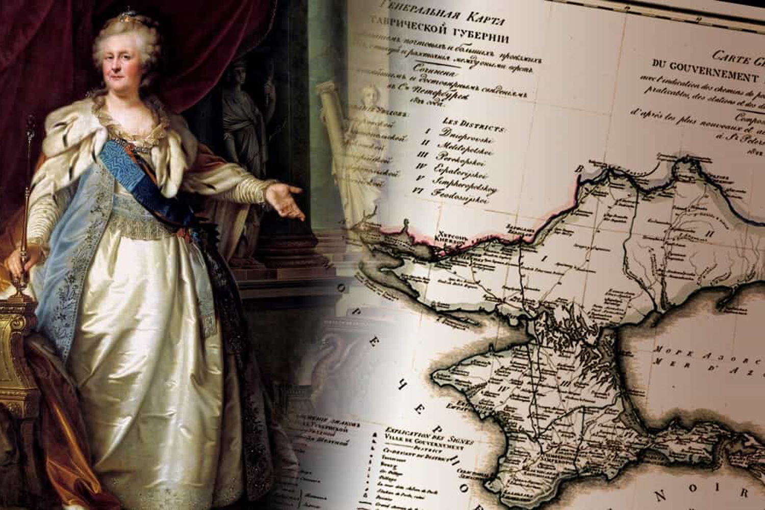
Since at least 2014, both blatant and subtle forms of propaganda have played a significant role in the ongoing Russian-Ukrainian war, furthering anti-Ukrainian narratives globally. Specifically, Russia has manipulated maps to artificially link temporarily occupied Ukrainian territories to Russia by altering their borders. This article delves into how Russia disseminates its propaganda via cartographic materials and highlights the complicity of international companies in this endeavour. Additionally, we explore an initiative to counter the propaganda Russia seeks to disseminate through these manipulated maps.
Since the onset of the war, Ukraine has grappled with the issue of inaccurate portrayal of its territories in textbooks and mapping products. Frequently, Crimea is mislabeled as a disputed territory, the Donetsk region is portrayed as an independent entity, and regions occupied since 2022 are wrongly depicted as part of Russia on certain maps. This distortion is not limited to Russian maps alone; even Ukraine’s partner countries have fallen victim to this propaganda.
With the collaboration of foreign publishing houses and cartographic services, Russia employs maps to reinforce its ideological narratives. These misrepresented depictions of Ukraine’s borders legitimise Russia’s unlawful actions and perpetuate myths that Ukrainian territories inherently belong to Russia.
The United Nations official website features a map illustrating Ukrainian territories’ internationally recognized and universally accepted borders per international law. These borders harken back to 1991 when Ukraine reclaimed its independence. Any deviation from these established borders distorts the understanding of the Russian-Ukrainian war and blurs the lines between the aggressor state and the defending nation. Such actions violate international law, undermine Ukraine’s territorial integrity, and directly contribute to a hybrid war.
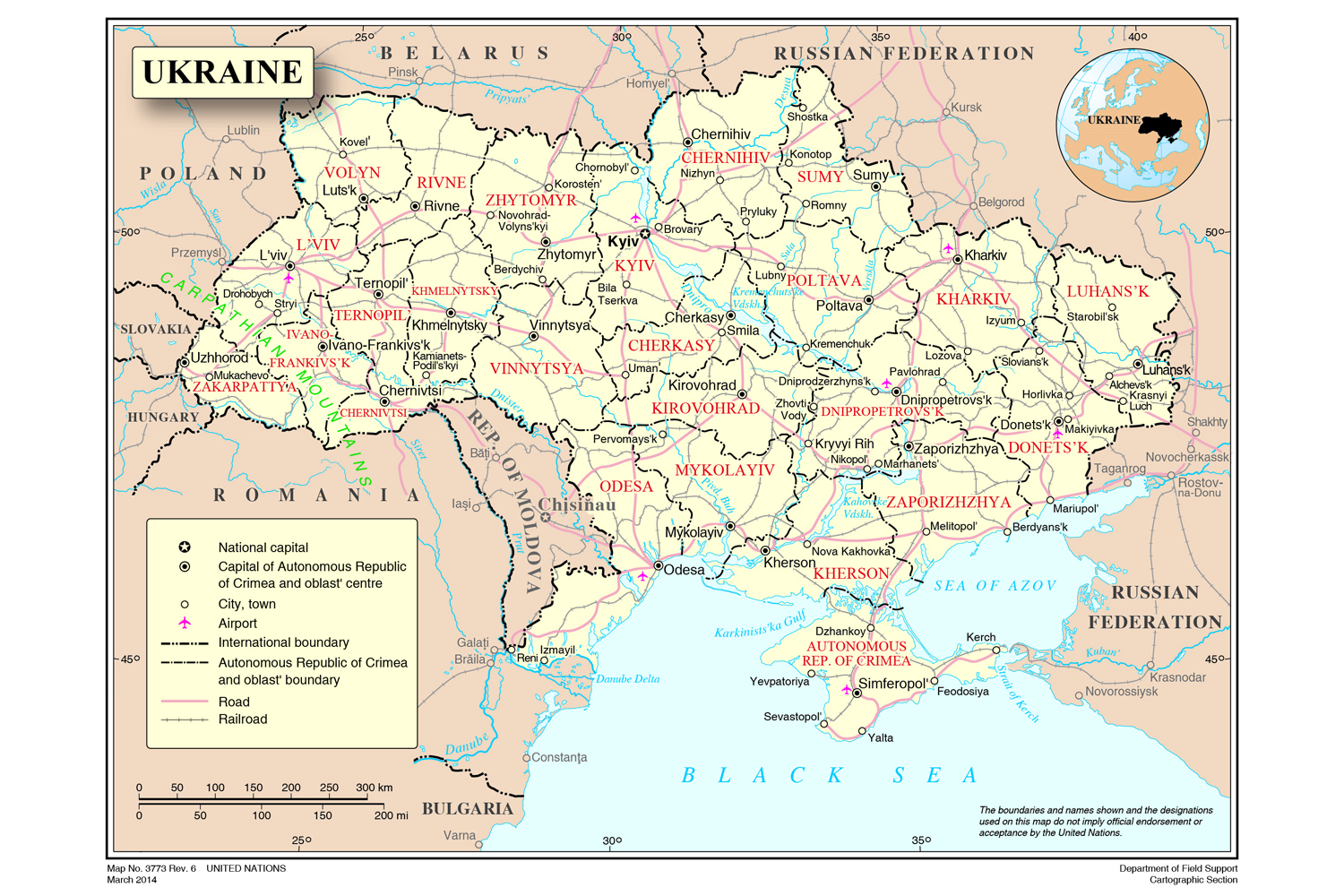
Sreenshot from the UN website.
A concerning trend emerges when examining the impact of distorted maps in educational materials from reputable manufacturers. These materials, presumed to be credible sources, often present inaccurate depictions of Ukraine. This misrepresentation, particularly in Western Europe, has led to a growing scepticism regarding the ownership of territories temporarily occupied by Russia. The consequence of this doubt is a reduction in public support for Ukraine, resulting in a noticeable deceleration in the supply of arms from partner countries.
Ukrainian activist Mykola Holubey decided to counter this issue by founding the NGO Stop Mapaganda! Information De-occupation of Ukraine. Holubey introduces the term “mapaganda,” a fusion of “map” and “propaganda,” to highlight the manipulation of maps. According to him, “mapaganda” represents a strategic tactic employed by Russia involving the deliberate falsification of Ukraine’s borders and those of other nations temporarily under the control of the aggressor state. This deceptive strategy is executed through foreign-made cartographic and educational products, including school textbooks, atlases, globes, and maps, which sow confusion and distort perceptions of territorial ownership.
The objective of the Stop Mapaganda project is to firmly establish that the only accurate representation of Ukraine’s territory adheres to the internationally recognised borders established in 1991.
Starting in early 2023, Mykola Holubey embarked on a comprehensive tour, visiting over 30 bookstores across various cities in Switzerland, Austria, Italy, and the Czech Republic. His mission was to assess their educational offerings, including school textbooks, global atlases, globes designed for both children and adults, wall maps, motorist atlases, electronic maps and encyclopedia services — essentially any source potentially containing depictions or descriptions of Ukraine’s territory. Mykola meticulously examined products available in online stores in these countries, as well as in the United Kingdom and the United States. Regrettably, most of the materials he scrutinized featured inaccurate representations of Ukraine’s territory.
Mykola’s extensive research identified more than 30 international companies responsible for producing and distributing cartographic products featuring falsified Ukrainian borders.
Mapaganda as an Imperial tactic
Throughout various epochs, there have been instances where maps served as a means of influence for powerful empires. Russia itself has employed such information warfare strategies. In the early 20th century, Moscow released a map envisioning a “future Europe” that would emerge following the conclusion of the First World War. These maps portrayed Moscow’s territorial holdings as considerably more extensive than their actual extent. In this depiction, the Russian Empire’s western boundaries encompassed the entire Kingdom of Poland, as well as territories like Königsberg (now Kaliningrad), Lviv, Chernivtsi, Krakow, Gdansk, and Poznan, even though, at the time of publication, these cities were parts of other sovereign states.
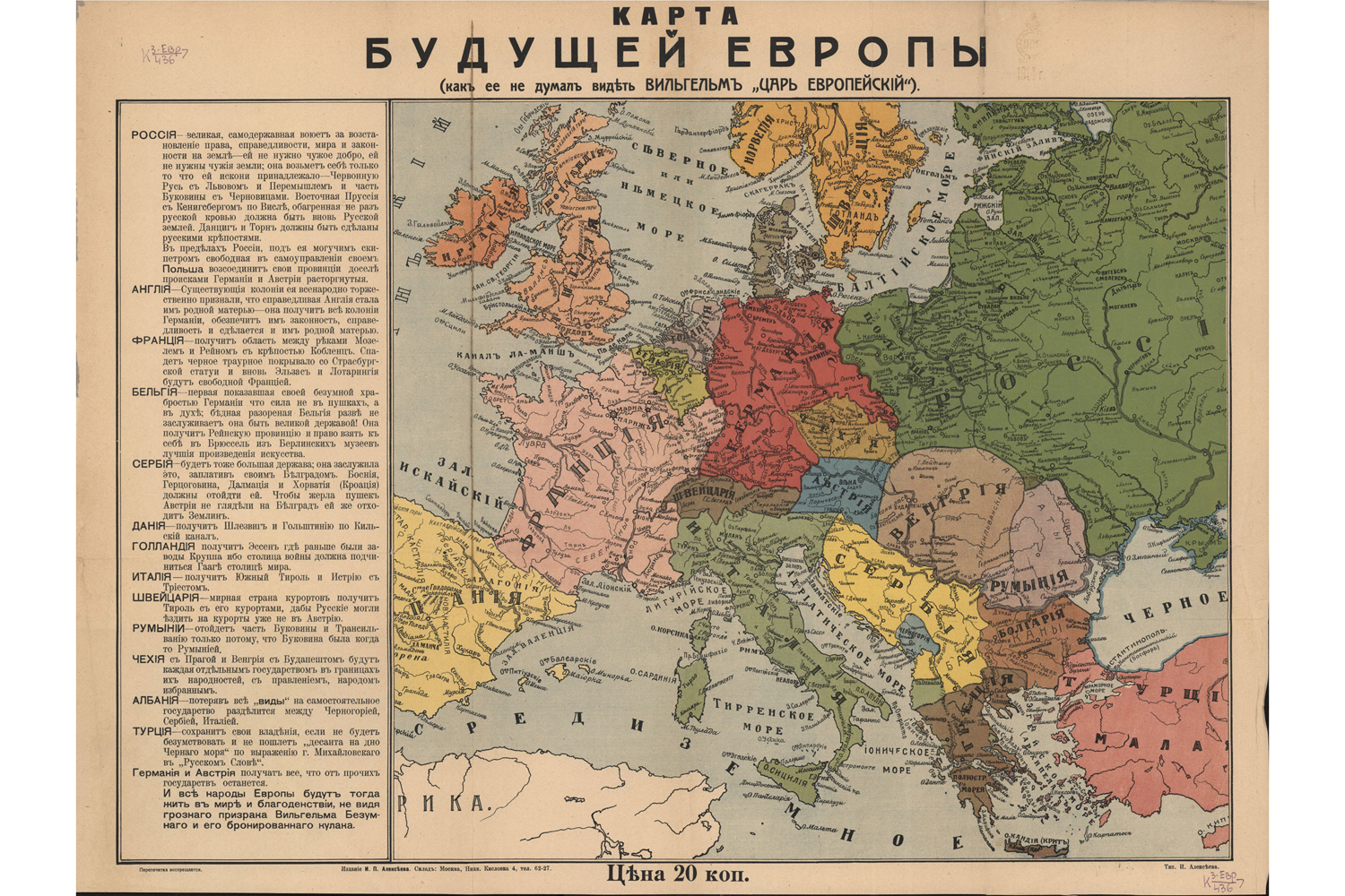
Screenshot: expositions.nlr.
“Mapaganda” extends beyond mere graphical alterations of national borders. Cartography has evolved into a potent tool for shaping people’s beliefs, enabling states to expand territories or cultivate animosity toward political regimes. This phenomenon was particularly prominent in the 20th century when maps featuring images and symbols designed solely to convey political ideas gained widespread popularity.
For instance, during the Second World War, the nations forming the anti-Hitler coalition disseminated maps that depicted a swastika ominously casting its shadow over Turkish lands or portrayed a colossal spider with Hitler’s likeness as its head, attempting to encroach upon all of Europe and parts of Africa with its sprawling limbs. Arachnids were also employed symbolically to designate Great Britain, which, according to these maps, purportedly laid claim to the entire European continent.
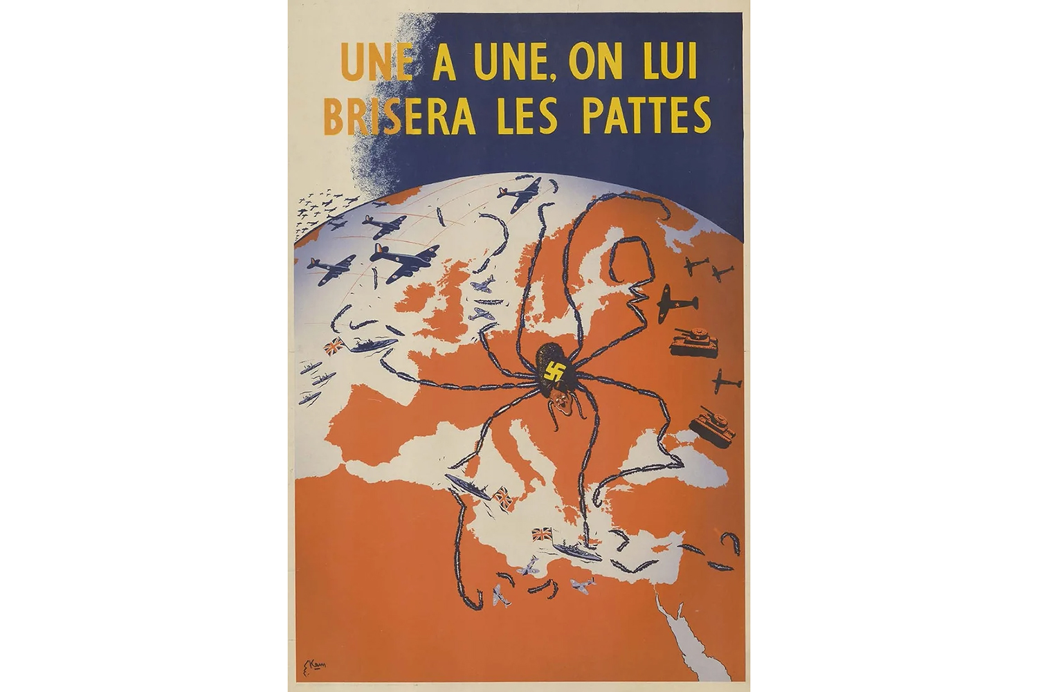
Screenshot: www.thegeostrata.com.
In 2014, when Russia initiated a war against Ukraine, China also heightened its longstanding threats of potential armed incursions into neighbouring territories. The Chinese government released an atlas that depicted Arunachal Pradesh, Jammu and Kashmir as Chinese territories despite their official recognition as part of India. In 2020, then-Pakistani Prime Minister Imran Khan published a map asserting Indian regions like Jammu, Kashmir, Ladakh, and Gujarat as Pakistani territories.
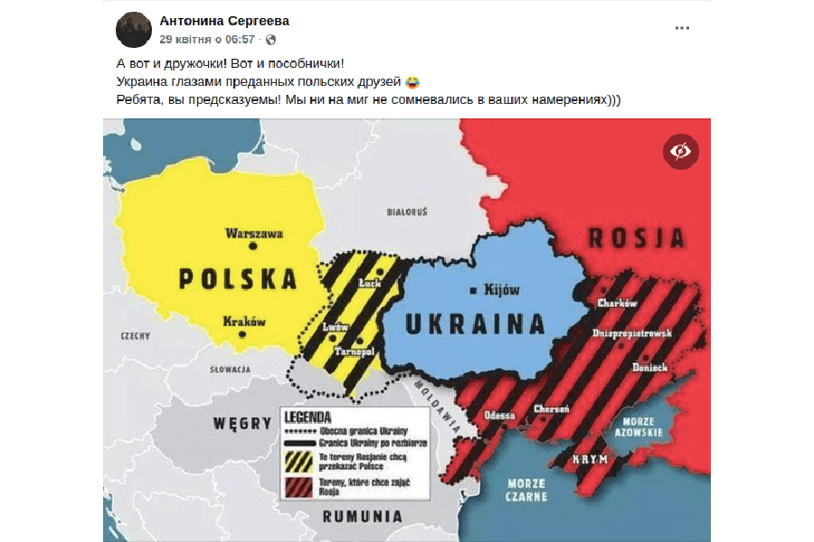
Following the occupation of Crimea and the Donetsk region, in addition to representing the temporarily occupied territories as part of the Russian Federation, the Kremlin actively propagated narratives about the potential partitioning of Ukraine among other nations. Russian politician and propagandist Vladimir Zhirinovsky made such propositions to Poland, Hungary, and Romania in March 2014. In response, a Polish newspaper, Super Express, published a map illustrating Zhirinovsky’s call to redistribute Ukraine’s territories. Despite the Polish government’s adverse reaction to the map, which depicted the transfer of Volyn and Halychyna to Warsaw, Russian propaganda media later employed various versions of this map.
Screenshot: Twitter.
How Russia executes “mapaganda” on the global stage
The epicentre of Russian cartographic propaganda is the Russian Geographical Society (RGS), an ostensibly non-governmental, scientific, and educational organisation founded in 1845 during the reign of Nicholas I. For a significant period, the RGS operated independently from Kremlin influence and relied on residual funding. However, a shift occurred in 2009, following the Russian war with Georgia (native name Sakartvelo), when the institution began actively engaging in propaganda efforts using cartography and inaccurate maps. These maps wrongly designated the temporarily occupied territories of other countries as Russian or disputed regions.
The political leadership of the Russian Federation assumed control over the organisation, with the newly established Supervisory Board being led by President Putin and Russian Defence Minister Shoigu being appointed as the President of the RGS. This board comprises influential Russian oligarchs and high-ranking officials, while the list of partners includes major state-owned corporations and entities such as Gazprom, RosHydro, Sovfracht, Russian Post, and more. The RGS is backed by propaganda media outlets and news agencies, including TASS, Channel One, Sputnik, Zvezda, Komsomolskaya Pravda, and others.
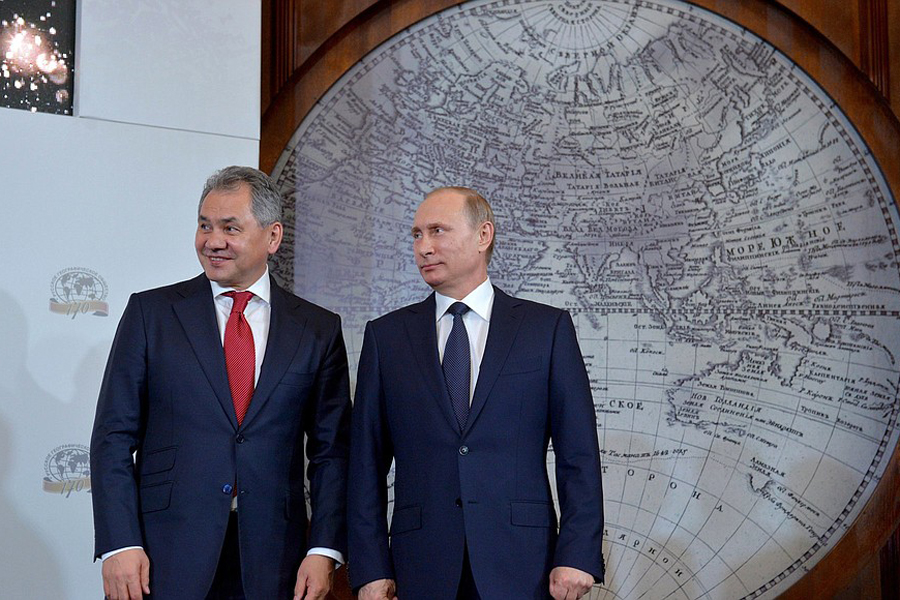
War criminal Putin and Shoigu.
Although the RGT officially declares its goal as “collecting and disseminating true geographical information,” it is becoming an important tool of hybrid warfare in the international and educational spheres. After the outbreak of Russia’s war against Ukraine in 2014, the society began to establish contacts abroad and cooperate with foreign scientific institutions. Thus, geographical societies of the USA, Germany, Spain, Italy, China, Turkey, etc. joined the list of partners. In 2016, during the RGT awards ceremony, Putin, answering a question about where Russia’s borders end, said that they “do not end anywhere.” His words provoked a storm of applause, although the Russian president later added that “it was a joke.”
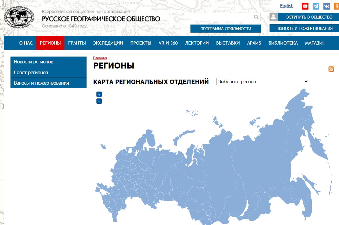
Screenshot from the RGT website.
It is equally significant that the RGT collaborates with private companies directly involved in disseminating Kremlin narratives and distorted depictions of Ukraine’s borders. Alongside Russian propaganda media, the renowned National Geographic organisation also contributes to the propagation of cartographic disinformation. Mykola Holubey conducted his independent research into the partnership between Russia and this American company, revealing that this collaboration has consistently deepened since the start of the war in Ukraine.
As early as March 19, 2014, the National Geographic team announced their intention to mark Crimea in grey, indicating it as a territory with a “special status,” following the ratification of the pseudo-referendum by the Russian State Duma. They also included an explanatory note regarding Russia’s occupation of the peninsula. The organisation applied similar principles to Russian-occupied Sakartvelo and other “disputed” territories. National Geographic explained that this approach aims to reflect the current reality on their maps as accurately as possible. Simultaneously, the organization emphasised that their depiction of Crimea does not signify support for its occupation.


slideshow
11th Edition, National Geographic Atlas of the World, – October 1, 2019(3).
11th Edition, National Geographic Atlas of the World, – October 1, 2019(4).
However, Mykola Holubey studied some of the National Geographic’s mapping products and found that the organisation marks Ukraine’s borders in five ways:
– Crimea as an integral part of Ukraine;
– Crimea is within Ukraine’s borders, but the peninsula has a different background colour compared to Ukraine;
– Crimea is a separate territory from Ukraine and the Russian Federation;
– Crimea as a territory of Russia;
– Crimea as a territory of Russia, which is “claimed” by Ukraine.
Creating several alternative opinions is a key strategy of Russian propaganda. It is used to confuse people who do not delve into the details of the Russian-Ukrainian war and to promote the narrative that “not everything is so clear.”
Educational products that support Russian propaganda
With the help of well-known companies such as Thalia.de and Hugendubel (the largest bookstore chains in Germany), Orell Füssli (their subsidiary in Switzerland), Amazon.de, Bucher.de and the UK-based Maps Worldwide, Russia has created a distribution system of more than 500 stores in the EU and the UK. They sell printed products of brands that produce maps with incorrectly marked Ukrainian borders. In this way, European and British distributors contribute to the “mapaganda.”
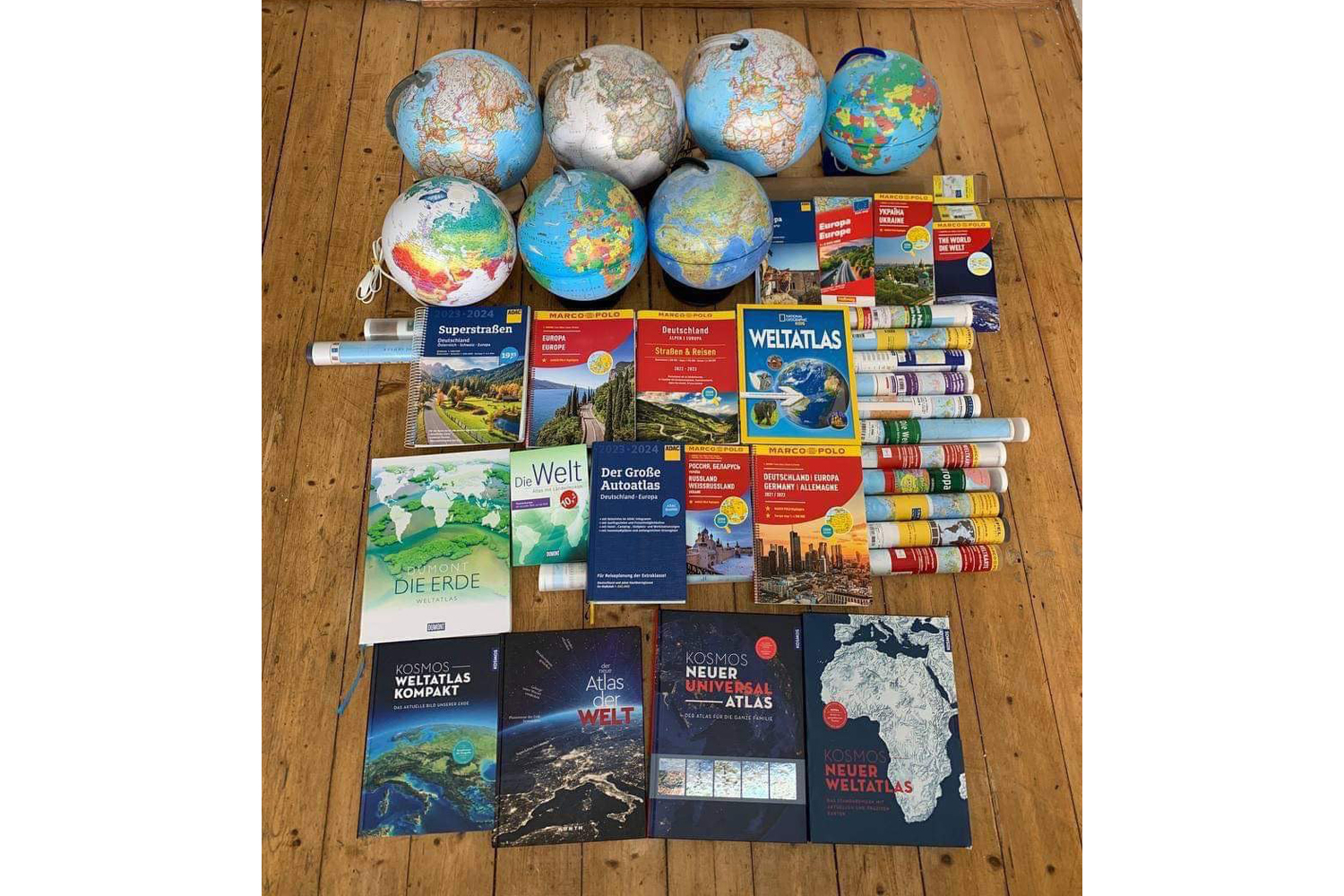
Photo of all collected materials provided by the author.
MairDumont
The largest publishing house in Germany that also owns subsidiaries, ADAC is a German brand under the auspices of MairDumont that specialises in the production of atlases for motorists and has more than 21 million active customers in German-speaking countries. The brand distributes cartographic products that depict Crimea, Donetsk, Tavria and Zaporizhzhia as part of Russia. Marco Polo and Dumont have the same policy, publishing atlases of the world.
Westermann
A leader in the German-speaking market for educational products for children, the company produces over half of the world’s atlases for German schools. On its maps, Westermann marks Crimea as separated from Ukraine in various ways: a disputed territory, part of the Russian Federation, or an independent state unit. At the same time, Moldova and Sakartvelo, which are also partially occupied by Russia, are depicted within internationally recognised borders.
Interkart
A German online store that develops its own maps and distributes mapping products of other brands, which depict Crimea as part of Russia. One of these companies is the Russian publishing house Agt Geotsentr. Interkart disguises it under the label “Made in Germany.” However, Ukraine is not the only country whose territory is incorrectly portrayed by the German company. Mykola Holubey noticed that on the world’s political map, Sakartvelo is coloured almost the same as Russia, which can lead to the country being mistakenly perceived as part of Russia.
Hallwag Kümmerly+Frey
The largest Swiss publishing house also actively spreads fake information about Ukraine’s borders. The brand marks Crimea as a disputed territory on its maps. However, the depiction of Ukraine’s borders on physical copies of the products differs from the one presented in the preview of the online store: the maps on the website show Ukraine’s borders correctly.
Räthgloben, Columbus, Ravensburger
Similar tactics are used by other companies that reproduce the territory of Ukraine on the Internet within the 1991 borders and redraw them on real products, duplicating the Russian propaganda position. In particular, these companies sell globes where Crimea is marked as Russian territory or disputed territory.
Online platforms that distribute distorted maps
Not only brands specialising in printed products use cartography to re-translate Russia’s position. Well-known online services are often among the companies that distribute incorrect maps. Ukrainians use one of them all the time.
Natural Earth
The well-known platform, which is used to create tens of thousands of maps, depicts the temporarily occupied territories of Ukraine as part of Russia. National Geographic largely duplicates the service’s position. It is supposedly designed to illustrate “actual” borders, not internationally recognised ones. However, this position applies only to Crimea and Ukraine. The territories also controlled by the Russian Federation (unrecognised Abkhazia and South Ossetia in Sakartvelo and Transnistria in Moldova) are depicted by Natural Earth as part of the states they are internationally assigned.
OpenStreetMap
The situation is similar with this online platform. OpenStreetMap depicts Crimea as a territory of the Russian Federation. At the same time, the company does not separate Transnistria from Moldova and unrecognised South Ossetia and Abkhazia from Sakartvelo.
Google Maps
The service demonstrates a rather controversial position, but not so openly. The search results vary depending on the country from which it is performed. If you search from Ukraine, Google Maps displays the correct borders, which were established in 1991. However, the situation changes if you search from the EU. The maps show Crimea, part of Ukraine, as a separate region. The same dotted line separates the peninsula from Russia. A query from the territory of the Russian Federation shows another result, the third one: Google Maps treats Crimea as part of Russia. At the same time, its competitor, Apple Maps, shows Ukraine’s borders correctly.
Liberating Ukraine in the information space
Cartographic manipulations have disastrous consequences for both Ukrainians and foreigners. Citizens of other countries, including the EU, are exposed to Russian influence through the pervasive penetration of propaganda, even at the level of education and the purchase of maps. This leads to a distorted understanding of the war and, subsequently to massive dissatisfaction with providing assistance to Ukraine among the populations of partner countries.
The self-proclaimed president of Belarus with a map. Photo from open sources.
Mykola Holubey assures that a comprehensive solution is needed to combat the results of mapaganda. The Stop Mapaganda! project has developed a strategy to counteract companies spreading map fakes, which consists of five levels of pressure: state, legal, public, media and sanctions.
The state level involves pressure from both Ukraine and other states where disinformation spreads. The Stop Mapaganda project is already working on this. Thanks to Mykola Holubey’s initiative, an interagency working group was set up to develop a mechanism for protecting Ukraine’s territorial integrity in the information space. The working group includes representatives of the Ministry of Foreign Affairs, the State Service of Ukraine for Geodesy, Cartography and Cadastre, the Ministry of Culture and Information Policy of Ukraine, and the Ministry of Education and Science.
The media stage of the fight against “mapaganda” is to make the problem visible in the Ukrainian and international media. National Geographic and the Amazon service, which freely sell incorrect mapping products, are well-known worldwide, so news of their involvement in the information war on the side of Russia could provoke a resonance. In addition, Mykola Holubey plans to organise a press conference in one of the EU capitals, involving international journalists, the Ukrainian Foreign Ministry, and embassies to highlight the issue on a global level.
To fight at the legal and judicial levels, the project team has developed the concept of the Ukraine Law Army. It “mobilises” legal experts to file a lawsuit against companies that distribute an incorrect image of Ukraine, thus violating its territorial integrity in the information space. Mykola Holubey notes that it is necessary not only to force foreign brands to stop producing fake products but also to remove the incorrect maps that are in circulation.
If the condition of removing the wrong products is not met, Stop Mapaganda will insist on adding unscrupulous companies to the sanctions lists. Thus, the sanctions level is reduced to liability for indirect cooperation with Russia in the information war.
Finally, the public level involves information pressure through social media on companies that spread propaganda through their products and support Russia in its hybrid war. Ukrainians and citizens of other countries interested in combating Russian cartographic manipulations can join in.
How can we resist “mapaganda”?
Mykola is convinced that public engagement is one of the main tools to combat mapaganda. Citizens of the countries where cartographic products that misrepresent Ukraine are distributed can pressure the authorities and influence their decisions in countering Russian propaganda. Therefore, it is essential to raise awareness of the problem in the first place in society.
The project team launched a flash mob to get as many people as possible to join the media pressure. Its main goal is to raise awareness among Ukrainian and foreign audiences about the harmful effects of mapaganda on their worldview. This initiative will provoke a discussion in Europe and other parts of the world and help counteract Russia’s manipulations. To join the flash mob, anyone can share information about companies that play along with the Kremlin on social media using the hashtag #stopmapaganda. There is also a special form on the project’s website where you can report cartographic products that incorrectly depict Ukraine’s borders. In addition, you can support Stop Mapaganda financially or become a volunteer and help develop the initiative. The project seeks specialists from various fields, including legal, communications and web design.
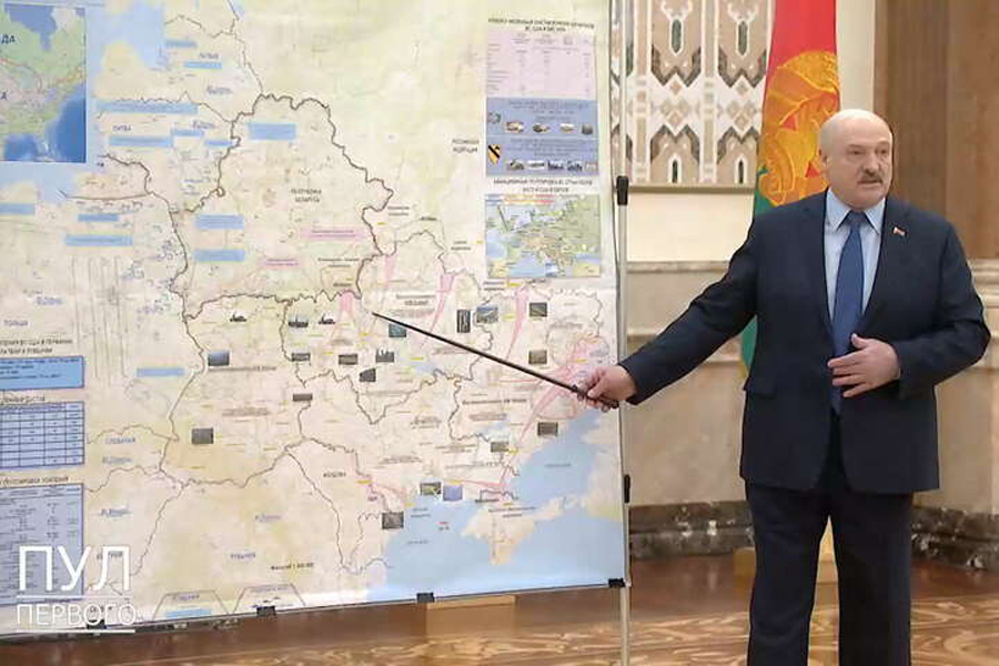
War criminal Vladimir Putin. Photo from open sources.
If the Russian Federation continues to interfere in shaping the worldview of citizens of democratic countries, it is only a matter of time before products depicting Poland, the Baltic States, and other Warsaw Pact states as part of the Russian Empire will appear.